Mt. Cheaha
21st January 2006
 |
 |
Here amidst a flurry of blogging, I’d like to talk about the wonderful
trip I had to Mt. Cheaha on Wednesday and Thursday of this week. Samford
hosted an orientation conference for new faculty at Bald Rock Lodge
located on top of Mt. Cheaha, Alabama’s highest point at 2407 feet.
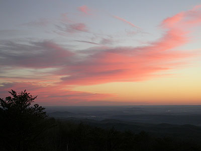
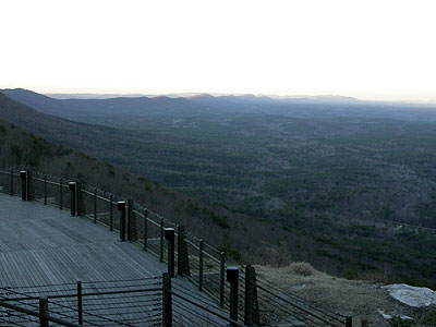
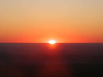
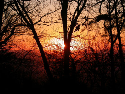
I took these two pictures above on Thursday morning right before the
sun came up over the Georgia horizon (Mt. Cheaha is near the border
of Georgia). The first picture is looking northeast. The second one is
looking southwest along the ridge. You can watch a short video of
the sunrise by clicking one of the two links below:
Download mpg (4.15 MB) |
Stream real (6.70 MB)
The conference was to help orient / redirect new faculty after
completing their first semester at Samford. It was a debriefing time
where we could talk about what is and isn’t going well. We also took
time to create a vision of how to improve Samford through our roles
as professors. It was an awesome conference, and I learned a lot.
One of the major highlights for me, though, was my longest bike
commute ever — from Birmingham 78 miles due east all the way to
Mt. Cheaha (pronounced “Chee-haw”). Here is a funny story relating
to the unique weather we get here in Alabama. On Tuesday, the high
was 61 degrees and we got 1.69 inches of rain. By Wednesday morning
the rain was long gone, but the temperature dropped significantly
all the way below freezing. This led to a winter weather advisory
for icy roads and bridges. I thought that that might be a problem
for me on my bike, but at 5:30 in the morning I wasn’t about to
give up before I even got started!
The temperature at our house was still 33 degrees, so that tempered
some of my concern as I left our house and rode down the very wet
hill outside of our house. Then I made it through the rest of
our neighborhood which also had very wet streets, but no ice! I
was running late so I decided to take the main highway, Us 280,
out of town all the way to Vincent — much farther than I had
originally intended.
The temperature reading on my new bike computer made it down to
30 and my feet were very cold by the time I made it to Vincent.
I noticed frost on the ground and ice in the puddles alongside
the highway. I also notice a couple bridges with a little bit
of ice on the shoulders — but no ice in the road! In Vincent, I
was able to pick up my intended route
on the next leg of my journey. I made it past Lake Logan Martin,
which was filled with sea gulls near the dam. Then when I was trying
to navigate through St. Clair county, I realized that I was having
to stop too often to pull out my map. I decided to go ahead and
take the short route directly to Talladega. I’m glad I did because
this route took me through the Sleeping Giants – a pair of mountains
separated by a road that goes right between them.
I flew through Talladega with a tremendous tailwind on the
last leg
of my bike ride. This was good because I knew by this point that I
wasn’t going to make it to the state park before 10AM when the conference was
supposed to start, and I knew that once I started climbing up to
the mountain, my pace would slow way down. I finally made it
up to the top and up to the lodge where I saw a large group of Samford
faculty members getting ready to enter the lodge. My first though
was that I had missed the entire first session! It turns out, however,
that they were just getting there, too. They had run into numerous
accidents because of ice on the interstate. So I wasn’t late
after all!
That was the funny story. Now for the pictures!
 |
 |
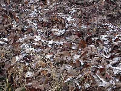
Right before getting to the top of the climb, I saw the remnants of a light
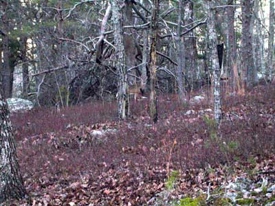
dusting of snow. The next morning before the sunrise I came across
a deer that leaped across the road in front of me. He/she stopped a little
ways into the woods. Can you find it in the center of this picture?
 |
 |
On Thursday morning, I got up early to go for a bike ride. When I realized it was
going to be a beautiful sunrise, I headed for the tower at the highest point of
the mountain so I could get some pictures. Here are the two best pictures I got
(one from the tower and one from the base of the tower). Also you can watch video by clicking one of the links below.
Download mpg (4.15 MB) |
Stream real (6.70 MB)
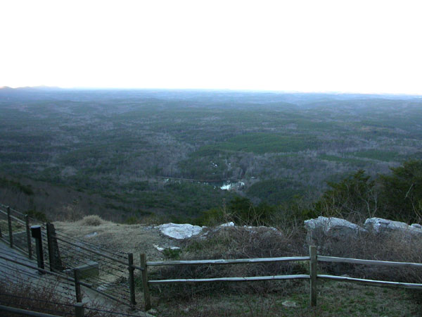
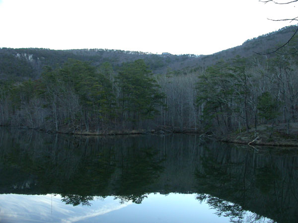
Finally, these are the two best pictures I have of the mountain. I took
the one on top first looking down the mountain towards a lake
that is also part of the park. You can see the road that goes
right up to the lake. The next picture (the one on the bottom)
is taken standing beside the lake looking back up at the restaurant
from where I took the first picture. The thing that I LOVE about
the second picture is that you can’t see the clouds and sky
above the mountain because of the sunrise coming up on the other
side, BUT you can see the clouds and the sky in the reflection
in the water. I think that’s cool. What do you think?
Well, I think this blog has gone on long enough. I’ll have to
blog about my ironman training later!
January 21st, 2006 at 9:53 pm
Hey Brian, glad to hear you are riding so much. My bike continues to sit in the shower “dusting” I am playing more bball so that is good but the bike is very lonely. I love the picture too, i really enjoy the reflection in the lake.
January 21st, 2006 at 10:04 pm
Awesome pictures!!!
January 21st, 2006 at 11:18 pm
I love you, my adventuring husband!!
January 23rd, 2006 at 10:28 am
“Bikeless”, you’ve got to get the bike out of the shower and get in shape! Tickets are only $163 + $30 tax round trip from Sacramento to Birmingham right now — for travel all the way through June! Check out my post on the South Side Bozos website for a link to travelocity to see the ticket options. Get that bike out of the shower so you can come ride with me in Alabama!